
Home ➣ LiDAR
Light detection and ranging
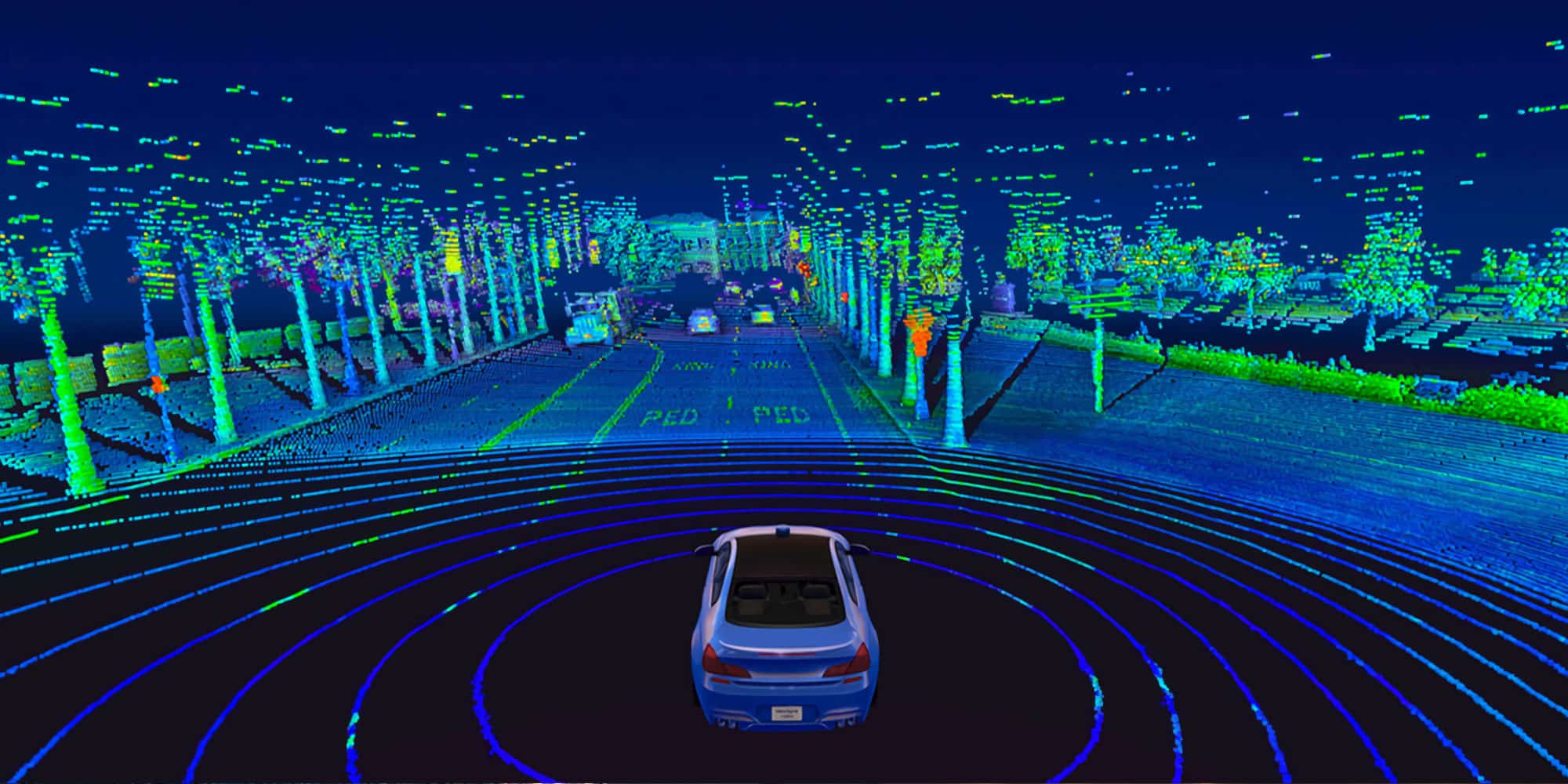
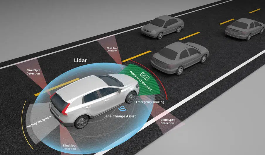
Light detection and ranging (LiDAR) is an established method for remote-sensing technology with promising potential to assist in mapping, monitoring, and assessing surfaces and objects. LiDAR technology allows scientists and professionals to examine natural and human-made environments with accuracy, precision and flexibility.
Webedition Technologies as a leading provider of state-of-the-art geospatial technology, we offer comprehensive LiDAR services tailored to meet the diverse needs of industries ranging from environmental management and urban planning to infrastructure development and precision agriculture. At Webedition Technologies, we harness the power of LiDAR technology to deliver accurate, high-resolution data acquisition that revolutionizes spatial mapping and analysis. Our advanced LiDAR systems, coupled with expertly trained teams, ensure precise data collection, enabling us to generate detailed 3D models, digital terrain models (DTMs), and point clouds with exceptional accuracy.
We provide Lidar mapping services like 2D & 3D base mapping, DTM and DSM creation, Forest inventory data creation, Electrical network, Telecom wired network and feature wise classification, projects within scheduled time. We’ve providing Lidar services to US and Canadian clients.
Why Choose Us?
We assist you for the following need in Lidar rollout:
- ➤ Aerial Lidar Classification
- ➤ Mobile Lidar – 2D Base mapping
- ➤ Mobile Lidar – 3D Base Mapping Using Mobile Lidar data
- ➤ Aerial Lidar – 3D Powerline string Generation
- ➤ Mobile Lidar – Electrical pole wire attachment extraction
Why we do it better?
Webedition Technologies is capable of undertaking and delivering simple to complex projects within the deadline fixed by the respective clients. Stringent quality measures are applied on each project to see that the design data are accurate and adequate to the complete satisfaction of the clients.